
EXPLORE THE
Park Highlights
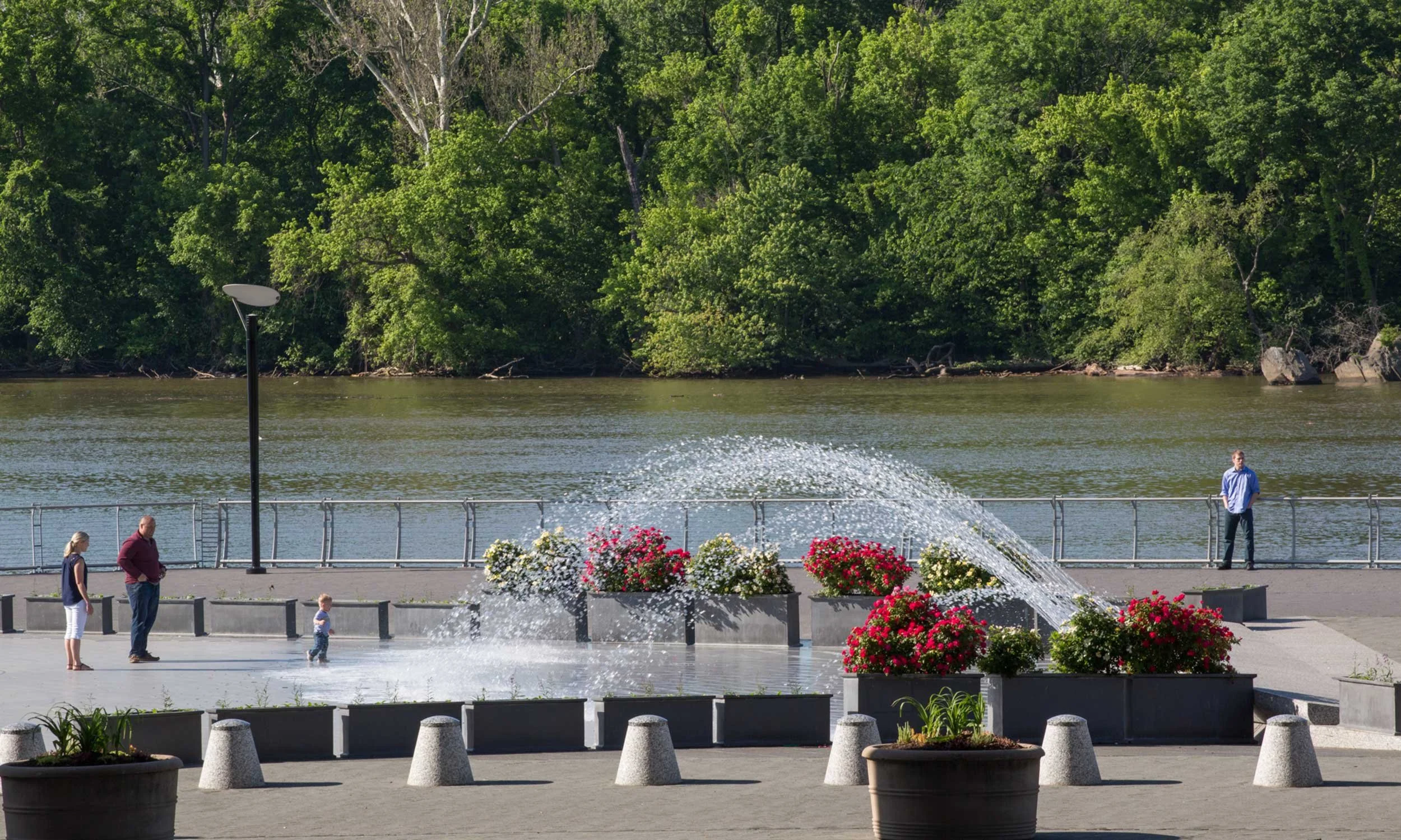
Fountain - The park's signature fountain is located at the main entrance to the park on Wisconsin Ave., N.W. On warm days the fountain attracts children who dash through the jets while grown-ups cool their feet nearby. After dark, the fountain is lit making it a natural stopping point on an evening walk along the river.
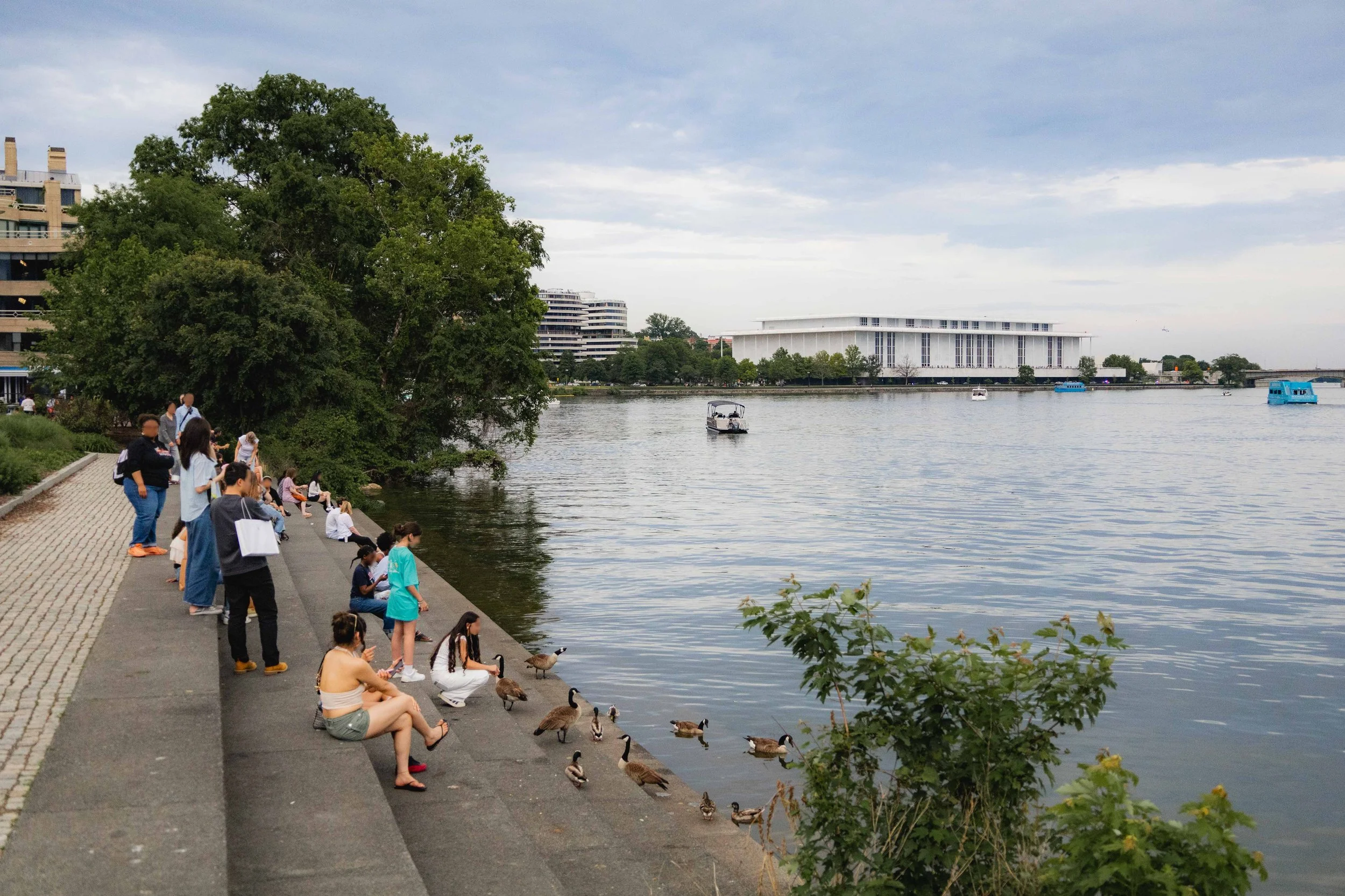
River Steps - Just east of the fountain, a set of granite river steps cascades down to the water's edge. Originally built to give spectators a perch at the rowing regatta finish line, the steps have taken on a life of their own — they're now one of the best spots in the park for a picnic, some birdwatching, or simply sitting and watching the river.
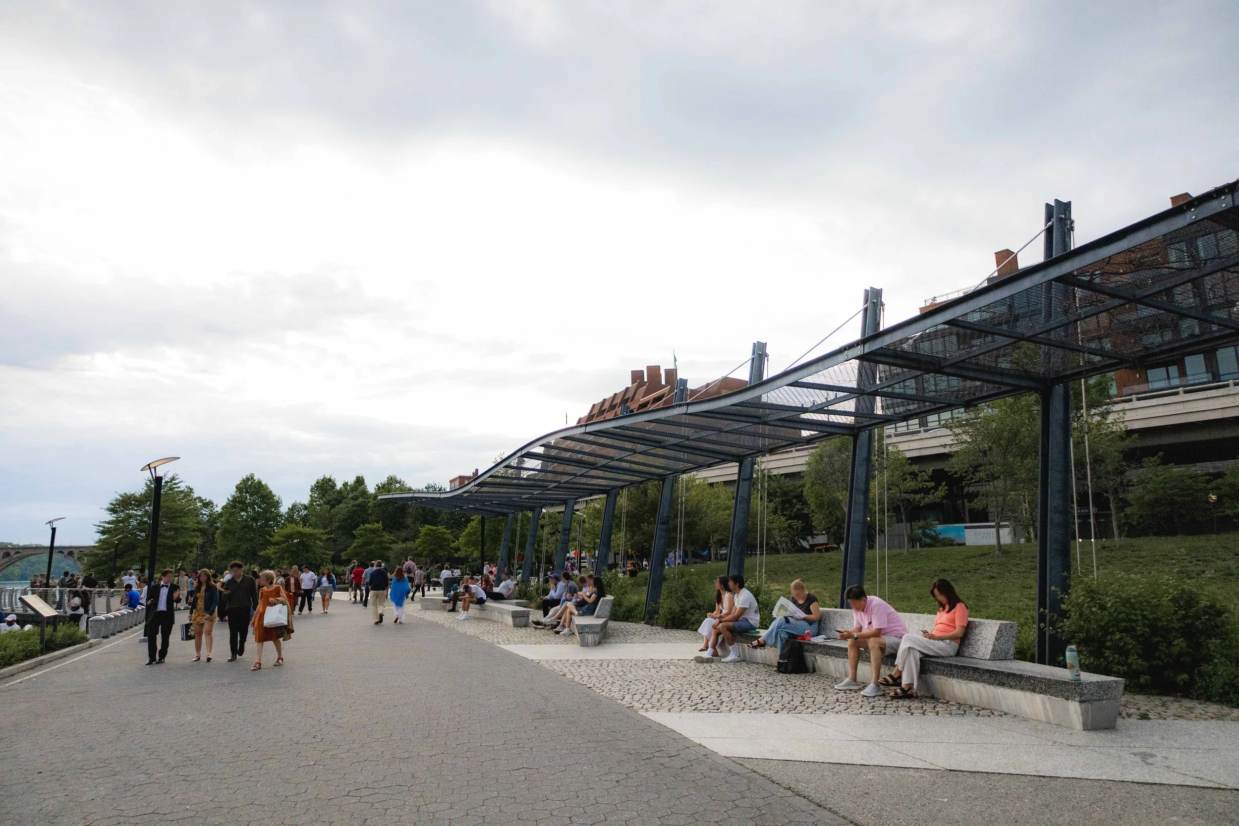
Pergola - Just behind the river steps, granite benches sit beneath a steel and cable pergola, its materials a quiet nod to the waterfront's industrial past. It's a lovely place to settle in and watch a regatta or just let the river hold your attention for a while.
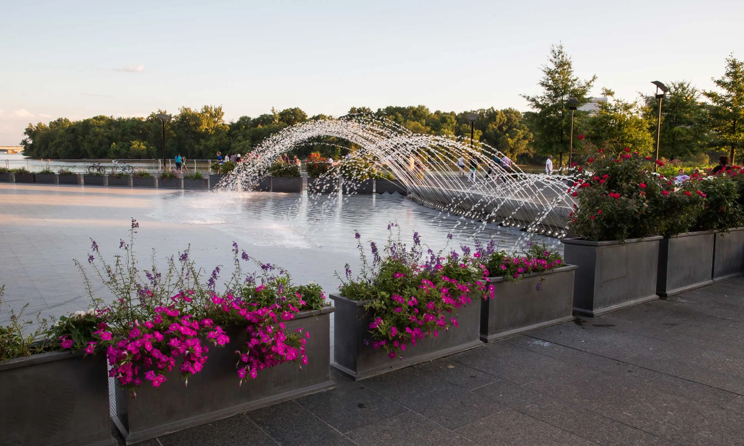
Senator Charles H. Percy Plaza - The main entrance to the park, where Wisconsin Ave. meets K St. N.W., is at Senator Charles H. Percy Plaza, named in honor of a man who spent decades championing this waterfront park. As a former Senator from Illinois, he co-chaired the Georgetown Waterfront Park Commission, which advocated for the park and for high school rowing programs. The local high school rowing championship, the Charles H. Percy Regatta, carries his name. The Percy-Rockefeller family made a significant contribution toward completing Phase 2 of the park, and the District of Columbia honored former Senator Percy’s legacy by naming the plaza in his memory.
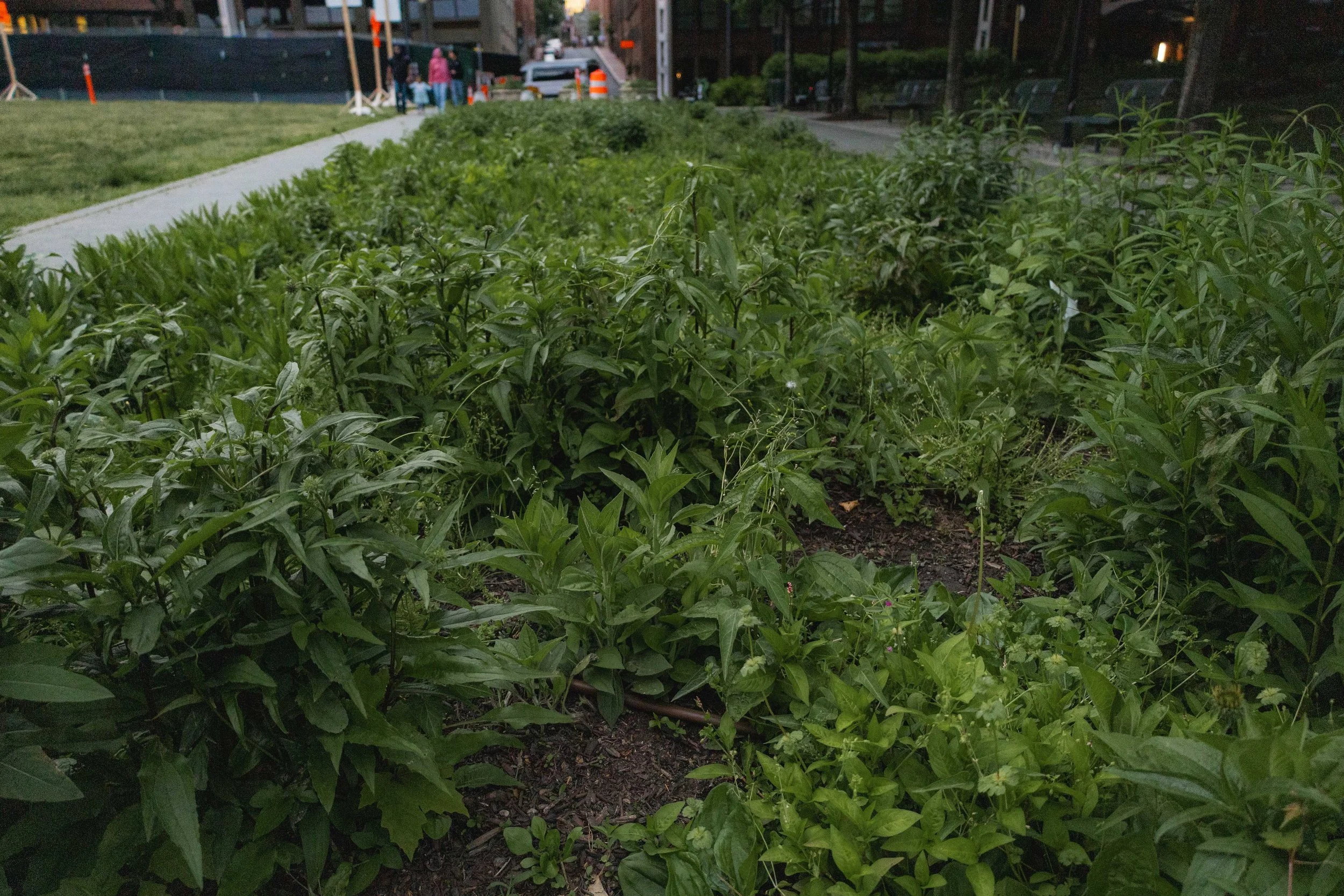
Rain Gardens - Scattered throughout the park, the rain gardens collect rainwater and stormwater runoff, holding it long enough to soak into the ground rather than flowing into storm drains. They help prevent erosion, reduce flooding, filter pollutants, and return moisture to the atmosphere. The rain gardens are filled with native species like Joe Pye Weed, Little Bluestem, New England Aster, Butterfly Milkweed, and more. Native plants are adapted to the local soil and climate. In a densely built city, they're a small but meaningful reminder of how nature can thrive in an urban environment.
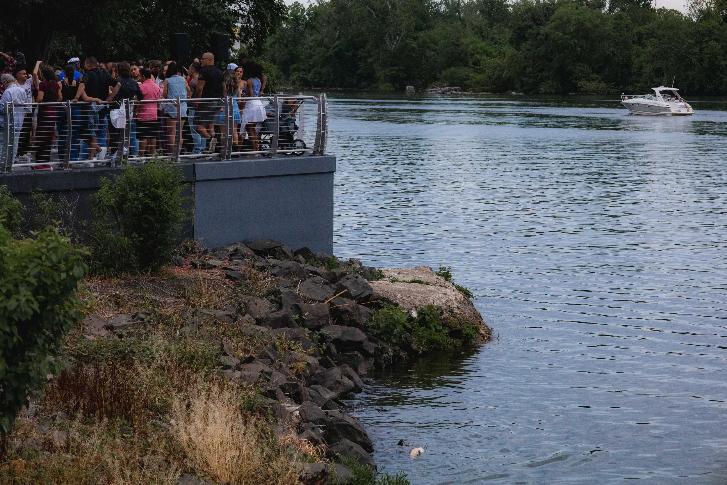
Bio Edge - A bio-engineered shore line replaces a crumbling concrete bulkhead that remained from the park's industrial past. The bio-engineered edge consists of layers of reinforced soil and native plantings that stabilize the shoreline and filter rainwater as it runs off into the river. The structure steps back horizontally as it rises above the waterline, with each level filled with a net-like geo-grid of packed soil that holds everything in place while letting water pass through. Native plants like sweet pepper, hydrangea, winterberry, mountain laurel, and arrowwood viburnum take root in the soil and change with the seasons, giving the bio-edge a look that varies throughout the year.
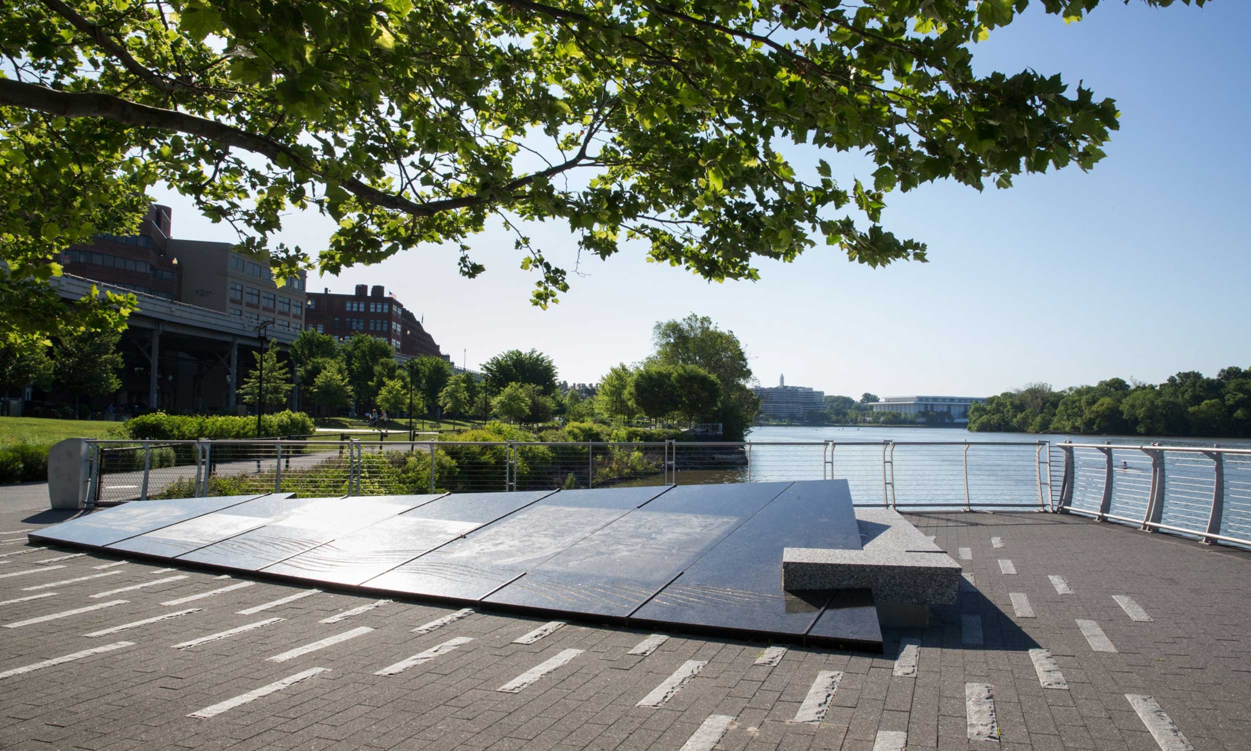
Overlooks - The western section of the park includes three overlooks that offer places to pause and take in the river. Each overlook features a granite slab etched with scenes from Georgetown's waterfront history. The first looks back at the waterfront between 1870 and 1970. The second highlights the Potomac's bridges and the long tradition of rowing on the river. The third depicts the Native Americans who navigated these waters during the colonial era, and a view of Georgetown when it was a thriving commercial port.
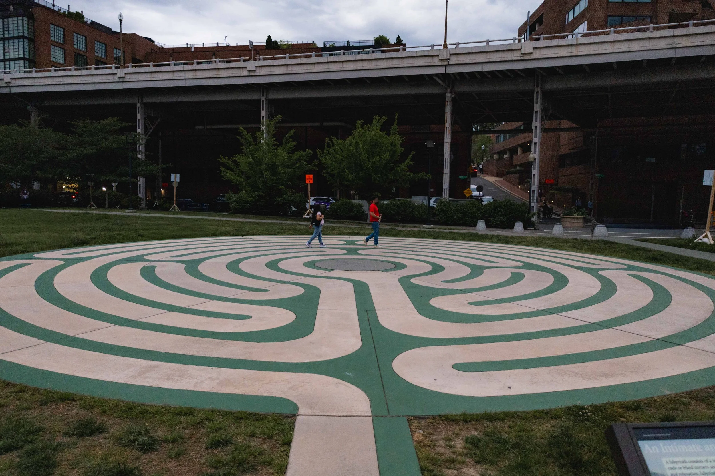
Labyrinth - Toward the western end of the park, you'll find the labyrinth — one of the park's most beloved spots. Labyrinths have been around since ancient times, designed to slow you down as you follow the winding path from edge to center. Many people find the walk meditative; kids tend to love it too, tracing the path on foot or by bike to the middle. The labyrinth was made possible by a generous gift from Nature Sacred, a nonprofit dedicated to urban green spaces and community healing. They also funded the nearby teak bench, which holds a diary where visitors can leave their thoughts after a walk.
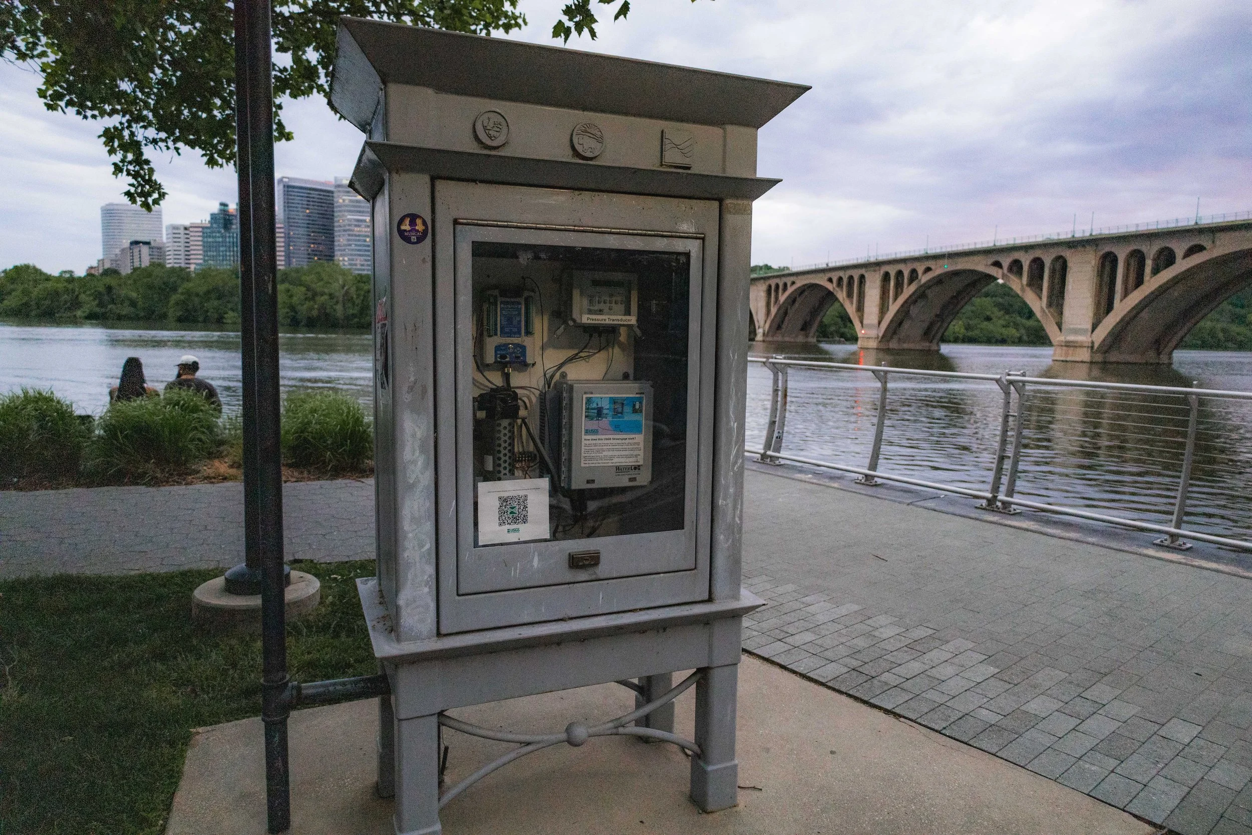
Streamgage - Near the western end of the park, close to 34th Street, you'll notice a streamgage, which is a scientific instrument used to measure the height of the river and track how it changes over time. The streamgage plays a role in flood forecasting, stormwater management, tidal monitoring, and climate research. The streamgage in the waterfront park is operated by the U.S. Geological Survey in partnership with the U.S. Army Corps of Engineers and the National Park Service. It is part of a national network of approximately 7,000 streamgages located across the country.